

Disclaimer
The information in this post is for general guidance only and is not a substitute for professional advice or official approvals. Always consult local authorities—such as the New Brunswick Department of Environment and Local Government (DELG)—for accurate permit requirements. If you have questions about your specific situation, I’m happy to help you find the right experts for waterfront and wetland development in New Brunswick.

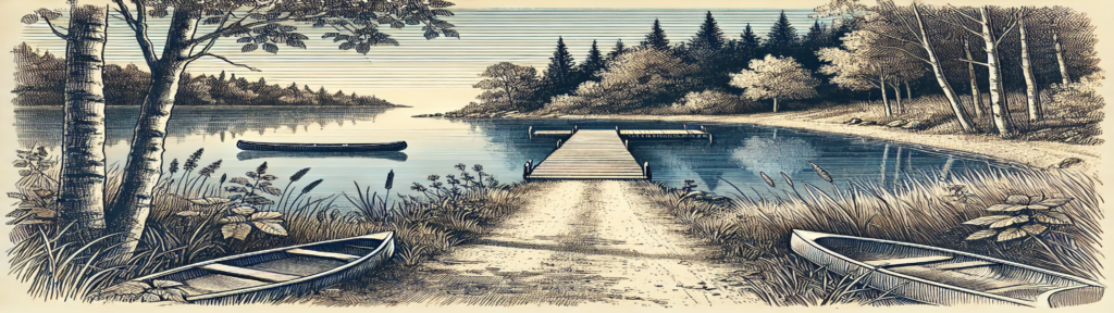
1. Why Waterfront Rules Matter: The Quick Overview
So you’ve got your eye on a piece of land by the lake—or maybe you’re dreaming of upgrading an existing waterfront spot. You might be thinking, “How will all these regulations actually affect me?” Let’s start with the short answer:
- Yes—You Can Still Develop Your Dream Waterfront Property
- New Brunswick’s guidelines don’t outright ban waterfront building or clearing of land; they just set certain boundaries to protect watercourses and wetlands.
- If you plan to build or modify anything within 30 meters (100 ft) of a watercourse or wetland, you’ll likely need a WAWA permit and sometimes a wetland delineation.
- Although it might sound complicated, these rules help preserve the natural beauty that draws you to the waterfront in the first place.
- Hiring Professionals Makes Life Easier
- Wetland consultants, licensed surveyors, and environmental experts handle the technicalities—delineating wetlands, filing permit paperwork, and ensuring compliance.
- Bringing them on board early can save you from surprise slowdowns or fines down the road.
- Lake/River Access Is Still Possible
- Want a dock or a cleared path for your fishing weekends? Absolutely—you just need to do it the right way.
- Limit vegetation removal, keep an eye on erosion control, and know that some activities (like adding fill) require extra approvals.
- When in Doubt, Ask
- Unsure if a new driveway or deck is too close to the water? Check with DELG or talk to a local pro.
- As a REALTOR® who often deals in waterfront properties, I’ve developed a good understanding of the process of developing on or near water courses and wetland and I’m happy to provide general advice. However, I ALWAYS recommend checking with certified experts prior to buying property or beginning a project. I can help you find the right people.
Bottom Line: The province isn’t preventing you from enjoying waterfront life; they’re simply making sure we respect the ecosystems that make these properties so special and preserve them for future generations. By understanding the basics, lining up professionals, and staying aware of possible permit requirements, you’re setting the stage for a smoother, more rewarding project.
Now that you have a quick idea of how these rules might affect your plans, let’s dig deeper into what actually counts as a watercourse or wetland, how wetland delineations work, and which permits you’ll need to keep your project on track and more.
2. The Basics: What Counts as a Watercourse or Wetland?
When you picture a watercourse, you may think of large rivers or serene lakes. However, in New Brunswick, a watercourse can be any channel—natural or human-made—that carries or contains water. Even small streams or ponds might be regulated if they show signs of flowing water or aquatic life.
Watercourses
- Defined as features primarily used to move or contain water.
- Includes rivers, lakes, streams, and human-made channels or ponds (especially if fish are present or they connect to a larger watercourse).
Wetlands
- Areas where the water table is at or near the surface long enough to support water-loving vegetation and hydric soils.
- In New Brunswick, wetlands over one hectare (2.47 acres) or those contiguous to a watercourse are typically regulated. Even smaller wetlands (≥100 square meters) may require delineation or protection.
Key Takeaway: A property that appears “dry” can still be considered a regulated watercourse or wetland. Always confirm with a qualified professional or check local maps and authorities before proceeding with any waterfront or wetland development in New Brunswick.

3. The Delineation Process: Identifying Wetland Boundaries
Before you begin any major development or clearing, it’s crucial to pinpoint where wetlands actually start and end. This is where wetland delineation comes into play.
What Is Wetland Delineation?
- A field-based process of identifying and mapping wetland boundaries.
- Relies on three parameters: hydrophytic vegetation, hydric soil, and wetland hydrology.
When Is It Required?
- In New Brunswick, any alteration (e.g., removing vegetation, landscaping) within 30 meters (100 ft) of a regulated wetland typically needs a permit.
- Wetlands ≥100 square meters often require a ground delineation before approval, and those ≥2 hectares may trigger a full Environmental Impact Assessment.
Who Performs Delineations and When?
- A qualified Wetland Consultant, trained in wetland hydrology, soils, and botany, must carry out the delineation.
- Most delineations occur between June 1 and September 30, though they can extend into fall if conditions allow (e.g., visible vegetation, unfrozen ground).
- Delineation reports are generally valid for five years; if significant changes happen or further work is planned, re-delineation may be needed.
Key Steps
- Identify “Paired Points”: At least one wetland point and one adjacent upland point per wetland type.
- GPS Mapping: Must be accurate within ±5 meters, using NAD 83 in decimal degrees.
- Detailed Reporting: Photos, data sheets, soil descriptions, vegetation info, hydrology notes, and consultant qualifications.
- Submission: A hard copy and digital version go to DELG’s Source and Surface Water Management Branch.
Why It Matters: Proper delineation keeps you within regulatory bounds and protects sensitive ecosystems. It also helps you avoid surprises like discovering, mid-project, that you’re too close to a wetland boundary—an expensive mistake to fix.
4. Permits and Approvals: The Watercourse and Wetland Alteration (WAWA) Permit
Even if you’ve mapped your watercourses and wetlands, you’ll likely need a WAWA permit for any project or alteration within 30 meters of these sensitive areas. WAWA permits follow a tiered approach to waterfront and wetland development in New Brunswick:
- Tier 1: Low risk
- Tier 2: Medium risk
- Tier 3: Higher risk (usually requires a full, standard WAWA permit)
Remember, no work can begin until DELG grants a permit or confirms an exemption. Activities often needing a permit include:
- Building or altering docks, bridges, or culverts
- Removing trees or vegetation within the 30m buffer
- Adding or removing fill (e.g., landscaping near the shoreline)
Key Takeaway: “Alteration” is interpreted broadly—if in doubt, check with DELG or hire a licensed professional first.
Permit Fees
- Standard Permit: $25.00 per alteration
- Multiple (Certification) Permit: $20.00 per alteration (max $200.00)
- Provisional Permit: $10.00 per alteration
- Emergency Permit: $50.00
- Renewal/Revision: $10.00 per request
5. Shoreline Modifications and “Grandfathered” Properties
Some waterfront property owners benefit from a shoreline cleared before modern regulations—often referred to as being “grandfathered in.” This can be a key selling point and may reduce red tape if you’re just maintaining existing features.
Added Value
- Properties with a cleared shoreline may command a premium because owners aren’t usually forced to restore what existed before today’s rules.
- Caution: If you plan to expand, rebuild, or significantly alter anything on the waterfront, you’ll need to comply with current standards.
6. Environmental Protection: What’s at Stake?
Preserving fish and wildlife habitats, preventing erosion, and stopping contamination are top priorities when considering the impact of waterfront and wetland development in New Brunswick
Why Wetlands Matter
Preserving fish and wildlife habitats, preventing erosion, and stopping contamination are top priorities for waterfront regulations. In fact, wetlands are some of the most vital ecosystems on the planet—especially in a region like New Brunswick. They:
- Provide Habitat: Wetlands support diverse communities of fish, birds, amphibians, and countless other species, making them hotspots for biodiversity.
- Naturally Filter Water: By trapping sediments and pollutants, wetlands improve water quality and help protect adjacent rivers, lakes, and streams.
- Reduce Flooding: Acting like natural sponges, wetlands absorb excess water during heavy rainfall or spring melts, lowering the risk of flood damage.
- Limit Erosion: Wetland vegetation stabilizes soil along shorelines, preventing erosion and helping maintain waterfront integrity.
- Sequester Carbon: Wetlands store carbon in soil and plants, making them essential allies in the fight against climate change.
These benefits not only safeguard the environment but also ensure long-term sustainability and enjoyment of New Brunswick’s beautiful waterfronts for generations to come.

7. Planning Your Waterfront Purchase or Project
If you’re eyeing a new waterfront lot or dreaming about upgrades:
- The Right REALTOR®: If you’re in the market to buy, choose a REALTOR® who fully grasps the complexities of developing, logging, or building on wetland or waterfront properties—someone who understands the regulations and knows how to use mapping tools to accurately identify watercourses and wetlands.
- Hire a Professional Advisor: A wetland delineator, surveyor, or environmental consultant can spot potential issues.
- Use Mapping Tools: Check the WAWA Reference Map and the DELG wetlands page for preliminary insights.
- Know Your Limits: Expect setbacks or special requirements if delineation identifies wetlands on-site.
- Future-Proof: Even minor additions (like a deck or boathouse) can trigger a new round of approvals—plan comprehensively to avoid multiple permit applications.
- Seasonal Work Restrictions: In-stream or near-stream projects generally happen between June 1 and September 30 to protect fish during their most vulnerable periods.
- Erosion and Sediment Control: Any disturbance of soil near water poses a risk of runoff. Tip: Install silt fencing, berms, or rip-rap (non-toxic, clean rock) to keep shorelines stable.
- Hazardous Materials: Keep fuel, chemicals, and other hazardous materials at least 30 meters from watercourses or wetlands—preferably with secondary containment.
8. There are options–Avoid, Minimize, or Offset
If you’re planning a waterfront or wetland development in New Brunswick that permanently impacts a wetland, expect to coordinate with DELG and a conservation partner—like Ducks Unlimited Canada—to offset those effects and help keep New Brunswick’s wetlands thriving.
- Core Principle: Developers must first avoid or minimize wetland disruptions. If significant loss is unavoidable, compensation measures must deliver a net gain in wetland function.
- Net Gain Mandate: Compensation can include restoring or enhancing existing wetlands, or creating new ones in previously unaffected areas.
- Third-Party Partners: DELG typically works with an outside organization to manage and verify these offset projects.
- Compensation Ratio: Replicating a natural wetland is difficult, so a ratio of 2:1 (compensation area : impacted area) is standard. That means for every acre of wetland lost, two acres of new or restored wetland must be established.
9. Already Own Waterfront? Here’s What to Keep in Mind
For existing waterfront homeowners:
- Maintenance vs. Alteration
Routine tasks—like cleaning a culvert or minor trimming—may get quick approval (Tier 1), but it’s always best to confirm with DELG. - Re-Delineation
Wetland boundaries are valid for five years. If you’re doing major improvements long after your original delineation, a new assessment may be required.
10. Penalties for Non-Compliance
All offences under the Clean Water Act follow the same fine structure:
- Individuals: $500 minimum, up to $50,000 maximum
- Companies: $1,000 minimum, up to $1,000,000 maximum
Real Case: In December 2017, a landowner was fined for failing to obtain a watercourse alteration permit and for ignoring a stop-work order under the Clean Water Act. He faced $2,500 plus a $750 surcharge (or 68 days in jail) for not getting the permit, and $5,000 plus a $1,500 surcharge (or 133 days in jail) for disregarding the order.

In Closing
Waterfront and wetland development or alteration in New Brunswick can be both thrilling and complex—but it’s far from impossible. In my experience, with regulations today most land owners are being granted approval to clear a 20m wide area that leads through that 30m buffer to the water. This is often dependent on the amount of shoreline disturbance has already occured on surrounding properties. So, between the 30-meter buffer zone, wetland delineations, and WAWA permit requirements, staying informed is your best strategy to protect both your investment and the natural environment that makes waterfront living so special.
- Grandfathered properties may reduce red tape if the shoreline was previously cleared, but any new changes must align with today’s rules.
- Engaging professionals early will help you navigate the process smoothly, from the first site visit to the final approvals.
Whether you’re considering a waterfront purchase or planning upgrades to your current property, I’m here to guide you. Let’s work together to ensure your real estate decisions align with local regulations—and keep New Brunswick’s lakes, streams, and wetlands healthy for future generations.
Ready to explore waterfront listings or discuss a specific project?
Contact me and let’s chart a course to your ideal waterfront living experience in New Brunswick.
Tim Clancy — REALTOR®
REMAX East Coast Elite Realty
506-567-8541
tim@timclancy.ca
timclancy.ca


")